Topography
Basic support for land planning and management is represented by topographical studies
Topography is the science that studies the tools and operational methods, both of calculation and drawing, which are necessary to obtain a more or less detailed graphic representation of a part of the earth’s surface.
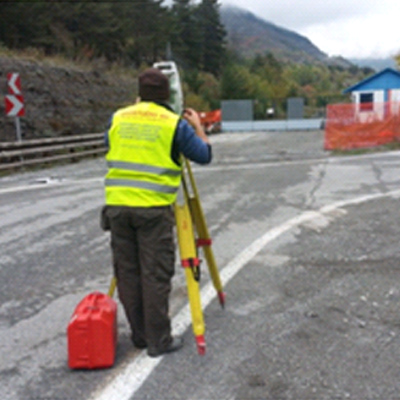
Operationally, topographic surveys are carried out with instruments such as Laser Scanners, Total Stations, GPS, SAPR (drones) for the acquisition of plano-altimetric information of the territory or of works and artefacts.

Territorial measures and controls
Topographic activity in the area is mainly focused on:
- High precision traverses and leveling;
- Constitution and materialization of orientation cornerstones;
- Design, measurement and calculation of geodetic networks;
- Monitoring of instability, landslides, slopes, glaciers;
- Monitoring and surveys of rivers, streams, lakes, reservoirs, embankments and cliffs;
- Site topographical assistance, tracing of complex works and structures;
- Land registry practices (land registry types, types of subdivision, stacking)
Whether it is natural processes or human activities, the world we live in is in continuous movement and transformation and these must be continuously monitored and measured to have a representation as close to reality as possible.
To best carry out the activities, Leica Motorized Total Stations are available (TS50 R1000 at 0.5″ seconds, TS15 R1000 at 1″ and 3″ seconds), a Leica GPS 900 Geodetic Station and a Leica DNA 03 leveling system as well as accessories necessary.
This topographic instrumentation, thanks to the highest angular precision (0.5″) and its electronic automatisms, is ideal for topographic monitoring and for surveys/trackings of both high and very high precision, also facilitated by the possibility of carrying out the activity with a single operator thanks to the integrated system that allows search and tracking of the prism as well as data recording and management via a remote controller.
Thanks to GPS, the data collected can be reported and framed cartographically with centimeter precision while our optical and digital measurement system for high precision leveling (precision 0.3 mm – standard deviation per km of double leveling) guarantees maximum accuracy and reliability in control and in the management of the data acquired with the use of the supplied software which also allows you to develop calculation functions for leveling lines, control of compensations, and creation of final reports for the analysis and verification of the data obtained.

Measurements and checks of works
The topographical analysis of works and artefacts is aimed at:
- Civil, industrial and public buildings;
- Squares, streets, tunnels, bridges, viaducts and railways;
- Pipelines, canals, sewers, technological networks, and systems;
- Quarries, storage areas and territorial areas;
- Structural monitoring and control of works;
- Monuments of a historical, archaeological, artistic, cultural and religious nature
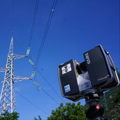
For this type of activity, among other instruments, two FARO FOCUS 3D laser scanners are available, compact, lightweight, suitable for applications in indoor and outdoor environments and dedicated to the three-dimensional modeling and documentation of objects, buildings, complex structures and systems. technological.
Capable of detecting up to 976,000 points per second as well as attributing the RGB value to each point detected thanks to the integrated 70 million pixel color camera.
The S120 model offers a medium distance scanning range (up to 120 m) while the X330 model offers a wider scanning range (up to 330 m).
