Geophysics
Seismic prevention in our territory is of crucial importance
Geo Logica supports designers and professionals in this delicate study phase with cutting-edge instrumentation. Our extensive experience in different areas of applied geophysics make us a valuable reference point for engineers and professionals in supporting their work. The land geophysical modeling, water research, archaeological geophysical investigations, detection of buried metal masses, detection of cavities are our main activities.
Downhole
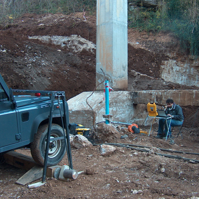
The Down-Hole seismic test in a borehole is aimed at determining the velocity profile of the seismic compression waves, P, and shear waves, S, and the elasto-dynamic modules of the investigated lithotypes that can be obtained from them.
It consists in producing, on the surface of the ground, a stress through a mechanical source, and in studying the wave trains that propagate within the ground in a longitudinal direction and transversal to the direction of propagation.
Using a receiver (triaxial geophone) in the borehole, the arrival time of the wave train is evaluated, dividing this by the distance between the source and the receivers, the speed of the longitudinal and transversal waves is obtained.
Determining the values of the elasto-dynamic modules that characterize the lithotypes crossed allows obtaining information about their nature and type of response to dynamic stresses.
The cementing of the borehole is important for the quality of the measurements.
It is a methodology that finds its field of application for the seismo-stratigraphic reconstruction of the subsoil, analysis and evaluation of its geomechanical and elastic characteristics, seismic microzonation, calculation of Vs30, etc.
Cross Hole and Tomographic Cross Hole
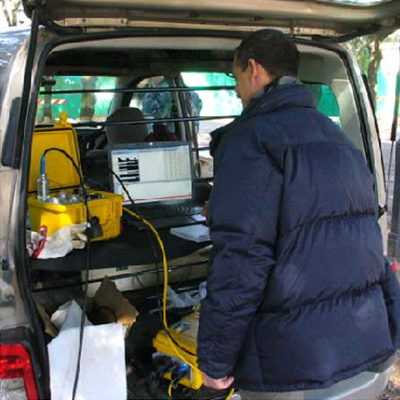
The Cross Hole seismic test in a borehole is aimed at determining the velocity profile of the seismic compression waves, P, and shear waves, S, and the elasto-dynamic modules of the investigated lithotypes that can be obtained from them.
It is applied using at least two sounding holes, one in which the receiver (triaxial geophone) is housed and the other in which the wave trains to be recorded are produced, with various methods and at the same depth as the receiver.
In this type of prospecting, the verticality of the two sounding holes must be carefully measured.
Similarly to the Down-Hole test, the determination of the values of the elasto-dynamic modules, which characterize the lithotypes investigated at the various depths, allows us to obtain information about their nature and type of response to dynamic stresses.
Also in this case, the cementing of the sounding holes is important for the quality of the measurements.
This is also a method that is applied for the reconstruction of the seismic-stratigraphy of the subsoil, detailed analysis of the geomechanical and elastic characteristics of the soil between the two holes, seismic microzonation, calculation of the Vs30 etc..
MASW
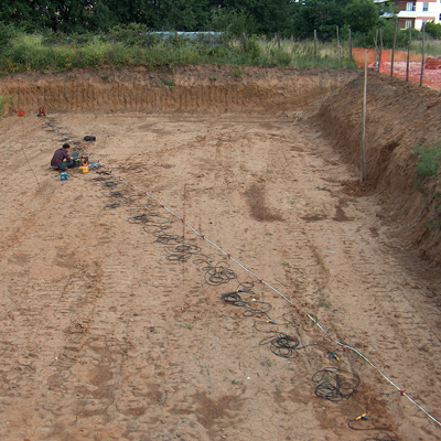
The MASW (Multichannel Analysis of Seismic Waves) tests allow determining the seismic parameter Vs30 with which to seismically classify the soil, for the purposes of anti-seismic regulations, deducing it from the trend of the velocity of the seismic shear waves (S) as a function of the depth in the first 30 meters from the foundation laying surface.
The speeds of the transverse waves are obtained from the study of the propagation and dispersion curves of the surface waves (or Rayleigh); the surface waves are produced by an impulsive source placed on the ground level and are recorded by a linear array composed of geophones capable of measure frequencies greater than 4.5 Hz, placed at regular distances from each other (intergeophonic distance).
The longer waves (long period and low frequencies) travel deeper giving information on the speeds of the deeper structures, while the shorter waves (short period and higher frequencies) travel deeper on the surface giving more detailed information on the more apical structures.
REMI
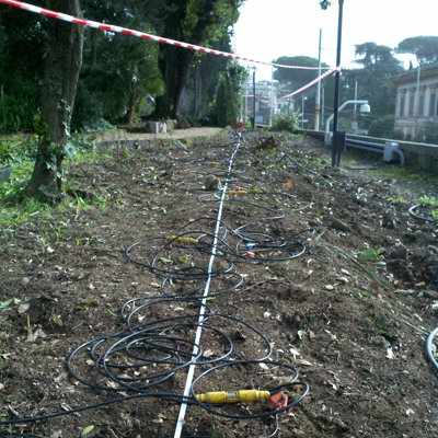
The ReMi (Refraction Microtremor) seismic investigation method is characterized, unlike the MASW method, by a type of “passive” acquisition of surface waves which are generated by the background noise (also called “microtremor”) produced by natural and anthropic sources (traffic, industrial activities, running water, wind, etc.) and which are recorded by a linear array composed of vertical geophones with a frequency of 4.5 Hz placed at regular distances from each other (intergeophonic distance).
The ReMi technique, by investigating spectral bands with low frequencies, allows us to have information on the trend of the Vs below the ground level of the site, and in particular in greater detail of the deeper portion of the seismo-layers of the subsoil, for the purposes of evaluation of the Vs30 parameter.
Often, if the logistics of the acquisition site do not allow theoretically optimal acquisitions of the MASW data, the ReMi acquisitions are integrated with the MASW for the measurement of Vs30.
Seismic refraction and tomographic
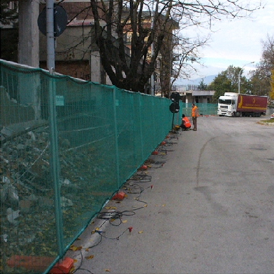
Seismic refraction prospecting consists in producing, on the surface of the ground, vertical or horizontal stresses using a mechanical source, and in studying the trains of waves that propagate, within the ground, longitudinally to the direction of propagation (P waves), or transverse to the direction of propagation and polarized in a horizontal plane (Sh waves).
In particular, the time necessary is measured for the elastic disturbance (P and S waves) caused in the ground by an energizer to be detected by an array of sensors (geophones) after having traveled through a superficial layer of ground (direct waves) and surfaces of separation between deeper layers and with increasing speed downwards (refracted waves).
The analysis of the arrival times of the elastic waves of compression (P) and shear (S) allows the reconstruction of the seismostratigraphy of the subsoil, evaluation of the elasto-mechanical, structural and hydrogeological characteristics of the lithotypes investigated. Limits of this investigation methodology it is the theoretical impossibility of investigating seismo-stratigraphies that present velocity inversions.
Seismic refraction surveys are also carried out in tomographic mode for detailed analysis of the characteristics of the subsoil.
Reflection seismic
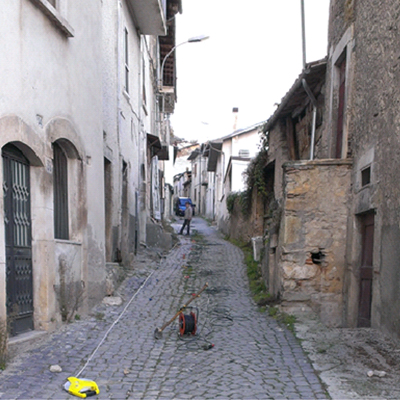
High resolution seismic reflection prospecting is a methodology used in the exploration of the subsoil to analyze its stratigraphic and structural structure, allowing to carry out a detailed geometric reconstruction of the lithostratigraphy of the subsoil.
It is also used in the study of foundations, research of aquifers, detachment surfaces that characterize landslides, identification of natural or anthropic cavities, etc.
The seismic reflection survey consists in the recording of wave trains, generated on the surface by an energy source, reflected by seismic discontinuities present underground, and due to lithological or structural differences. The analysis of the recordings allows us to reconstruct the trend and depth of the various discontinuities, allowing us to outline their geometry.
Reflection seismic surveys, unlike refraction surveys, are not negatively affected by the presence of seismo-stratigraphies that present velocity inversions, as they are based on the impedance contrast existing between the investigated materials.
HVSR
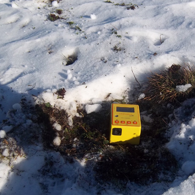
Thromography, or analysis of spectral ratios (HVSR: Horizontal to Vertical Spectral Ratio), consists in the recording of environmental seismic noise (microtremors) produced by natural or artificial sources of small amplitude (1 – 10 nm) and made up of surface waves such as Rayleigh waves and, to a lesser extent, Love waves.
The analysis of the recordings allows us to evaluate the characteristic resonance frequencies of the ground at the investigation points, or even of structures.
From a geological-geotechnical point of view, the frequency range of interest is between 0.0 and 20.0 Hz, frequencies which in the event of seismic events could negatively influence the dynamic behavior of buildings.
HVSR measurements are also used for seismic microzonation and local seismic response (RSL) investigations to estimate the depth of seismic bedrock.
Accelerometric Measurements
Electrical tomography analysis allows you to obtain 2D and 3D sections of soil resistivity from which the location and definition of lithological and structural inhomogeneities or buried materials are obtained.
The electrical tomographic method is based on the analysis of the apparent resistivity (referring to a non-homogeneous ground) through measurements of the intensity of the electric current, sent into the ground via a pair of electrodes, and of the voltage recorded by a second pair of electrodes along linear profiles or two-dimensional.
The methodology is used for the reconstruction of electrostratigraphy and subsoil structures (faults, cavities, etc.), identification of the phreatic surface, localization and delimitation of leachates and polluting liquids, survey of the geometries of illegal landfills, estimation of the depth of the waterproof substrate of superficial aquifers, fresh/salt water interface, archaeological investigations, electrical logs in the borehole, etc.
In particular, the electrical tomography analysis was an implementation for more detailed analysis of geoelectrical techniques such as SEV (Vertical Electrical Soundings), which are dedicated to the reconstruction of vertical resistivity profiles and for hydrogeological research (even up to great depths), and SEO (Horizontal Electrical Surveys) dedicated to the production of resistivity profiles and rectangles.
Georadar
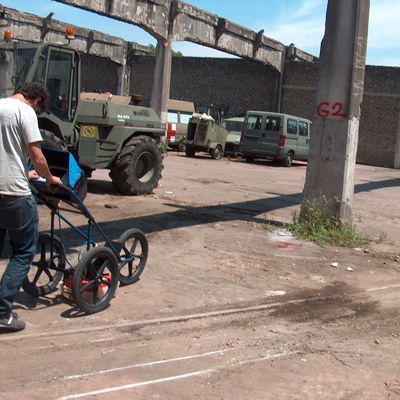
The G.P.R. investigation (Ground Penetrating Radar) is a non-destructive geophysical diagnostic technique, which allows you to obtain images of two-dimensional or three-dimensional sections of the ground and/or structures investigated for a depth that depends on the type of materials and the type of sensor used.
The ground penetrating radar method is based on the generation of high frequency impulsive waves (generally between 25 and 2000 MHz) which can be introduced into the body to be investigated with an appropriate (transmitting) antenna. The measured parameter is the propagation time of the wave which, upon encountering obstacles or discontinuities, returns to the surface and is picked up by the (receiving) antenna as a reflected echo.
Images are obtained that represent the sections or volumes traveled by the mobile antenna on the investigated surface.
The areas of application of the GPR methodology can generally be identified as: environmental prospecting, geotechnical investigations, architectural studies, archaeological research, search for underground services, structural monitoring, identification of cavities and hidden objects.
Electrical Tomography
Electrical tomography analysis allows you to obtain 2D and 3D sections of soil resistivity from which the location and definition of lithological and structural inhomogeneities or buried materials are obtained.
The electrical tomographic method is based on the analysis of the apparent resistivity (referring to a non-homogeneous ground) through measurements of the intensity of the electric current, sent into the ground via a pair of electrodes, and of the voltage recorded by a second pair of electrodes along linear profiles or two-dimensional.
The methodology is used for the reconstruction of electrostratigraphy and subsoil structures (faults, cavities, etc.), identification of the phreatic surface, localization and delimitation of leachates and polluting liquids, survey of the geometries of illegal landfills, estimation of the depth of the waterproof substrate of superficial aquifers, fresh/salt water interface, archaeological investigations, electrical logs in the borehole, etc.
In particular, the electrical tomography analysis was an implementation for more detailed analysis of geoelectrical techniques such as SEV (Vertical Electrical Soundings), which are dedicated to the reconstruction of vertical resistivity profiles and for hydrogeological research (even up to great depths), and SEO (Horizontal Electrical Surveys) dedicated to the production of resistivity profiles and rectangles.
